Maply supports you to see public transit, subway or metro lines in and around the cities, real time road traffic conditions, and bicycle paths, when each respective layer is turned on.
Public transit layer
Real time traffic condition layer

Bicycle path layer

Worldwide coverage
Maply is powered by Google Maps so you can expect one of the largest worldwide coverage including most countries and cities on earth.
Steps to turn on the layers
The steps below assume you have a map created. If not, click on My Maps page to create one.
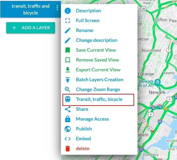
- Click on the menu icon next to the name of your map and choose Transit, traffic, bicycle option. A pop up window appears.

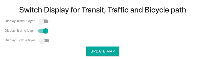
- Switch on layers you want to display and click the UPDATE MAP button.

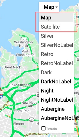
- Your map is updated with the selected layers displayed. (Note: selected map type needs to be Map or Satellite in order to see these layers.)