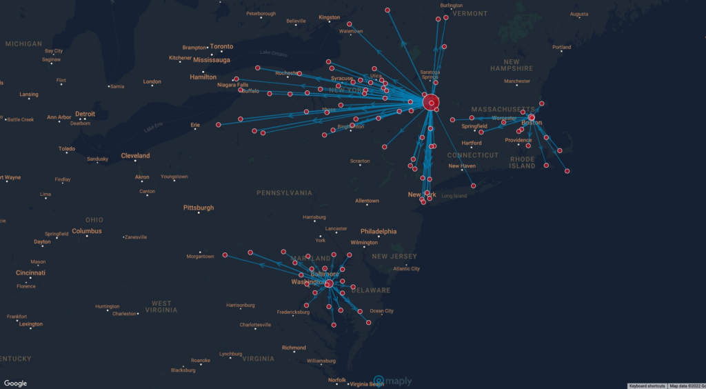
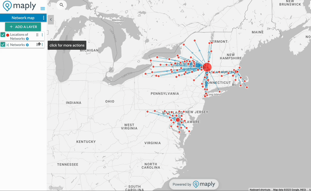
What is Geographic Network Map
A geographic network map shows how places are connected in the real world by layering relationships—like supply chains, delivery routes, office-to-employee links, or distribution networks—on top of a map. It turns complex data into a clear picture of how everything fits together.
With these maps, it’s easy to see connections that matter:
- Offices and where employees live
- Distribution centers and the stores they serve
- Restaurants and their customer base
- Schools and the neighborhoods of teachers and students
Whether you’re managing logistics, planning operations, or simply exploring relationships between locations, geographic network maps help you understand and communicate your data at a glance.
How to make a network map
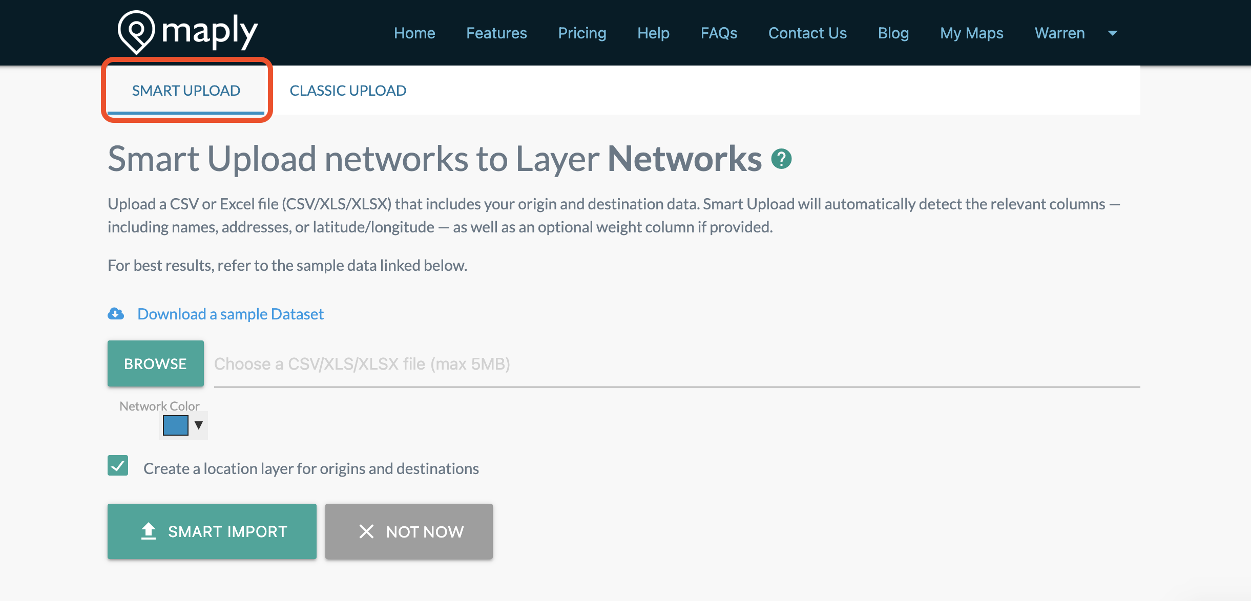
Network maps, which is generally not available in other mapping software, is a unique feature of Maply. The steps of creating a Network map is very similar to creating a location map.
The default way of uploading data is using Smart Upload. Smart Upload will automatically intelligently detects the relevant columns, including names, addresses, or latitude/longitude of the origin and the destination— as well as an optional weight column if provided. Guidelines are similar to that of Smart Upload for location map, with the exception that both Country of the Origin and Country of the Destination are required.
For Classic Upload you need to use the Maply Network Map Excel Upload template. Each record is a line with origin and destination.
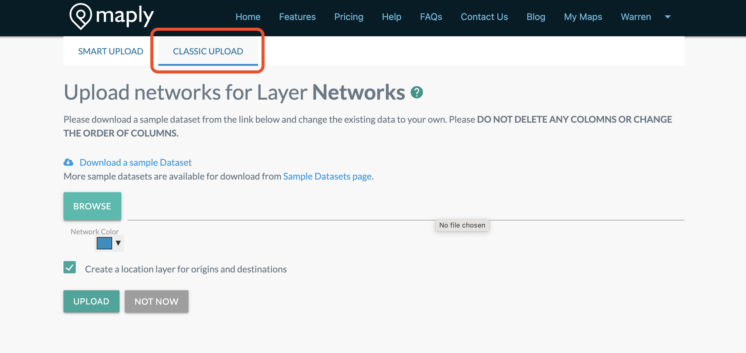
Maply also supports weighted network maps. Lines with larger weights will be displayed thicker, representing heavier traffic. If no weight is provided, all lines will be assumed to have an equal weight of 1.
Structure/format of Maply Network upload template:
| Column | Header | Description | Remarks |
|---|---|---|---|
| A | Orign Name | Name of the origin. | Optional. |
| B | Origin Address | Address of Origin. | Optional. |
| C | Origin Postal Code | Postal code of the origin. | Optional. |
| D | Origin Country | Country of the origin. | Required. If this is not filled, Maply will give error message saying that address info is missing. |
| E | Origin Latitude | A.k.a. Lat, this is the latitude of the origin. | Optional. Usage limits apply. |
| F | Origin Longitude | A.k.a. Lng, this is the longitude of the origin. | Optional. Usage limits apply. |
| G | Destination Name | Name of the Destination. | Optional. |
| H | Destination Address | Address of Destination. | Optional. |
| I | Destination ostal Code | Postal code of the Destination. | Optional. |
| J | Destination Country | Country of the Destination. | Required. If this is not filled, Maply will give error message saying that address info is missing. |
| K | Destination Latitude | A.k.a Lat, this is the latitude of the destination. | Optional. Usage limits apply. |
| L | Destination Longitude | A.k.a Lng, this is the longitude of the Destination. | Optional. Usage limits apply. |
| M | Weight | A measurement associated to this line, e.g. volume, number of shipments, number of flights, etc | Optional. When available, lines on the network layer will be displayed according to its weight. Heavier line will be thicker. |
While you are free to change the contents of the columns, including the headers, it’s important to keep the structure unchanged. Please don’t delete an columns or insert new columns. Otherwise, the upload might not go through. You can leave the optional columns empty.
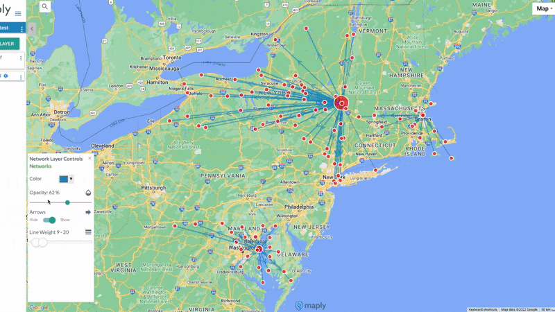
Network Map Control Panel
You can use the Network Map Control Panel to adjust the look and feel of your map to make it uniquely yours. Hope the example below gives you some inspiration.
Coloring by origins and destinations
From the Network Map Control Panel, you can color your networks by origins and destinations. Maply automatically detects lines that share the same starting point or endpoint and assigns them a common color—making it easy to distinguish between different routes at a glance.
Splitting a network map by origins and destinations
You can also split your network map layer into multiple layers by destination or by origin. After the split, you have more controls on individual layers, such as changing their color and opacity. Below is a step-by-step guide.
- Press the three dots icon next to your network layer
- Click on ‘Split by Origin / Dest.’
- Select select the desired option (you can select the option to also delete the original layer after split is done)
- Tada! You now have multiple network layers based on your choice. Try messing around with the colour, line weight, opacity on each new layer
Getting driving distance and time
With network maps, you can also get driving distances and travel time, as well as flying distances between multiple origin and destination pairs you are interested in at one go.