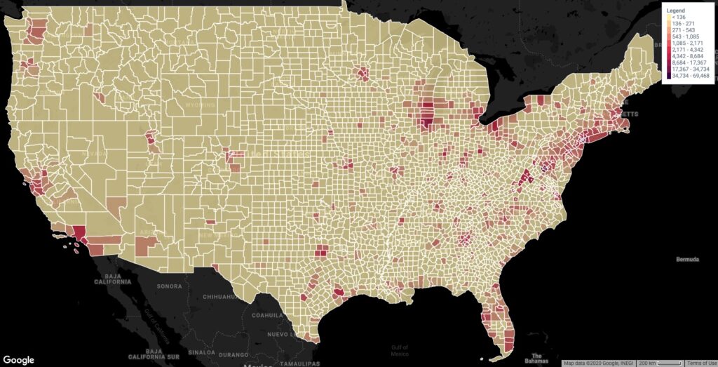
Introduction

A Geographic Information System (GIS) is a powerful tool that allows users to visualize, analyze, and interpret spatial and geographic data. By integrating various types of data, GIS helps in understanding patterns, relationships, and trends across geographic spaces. Its applications are vast, ranging from urban planning and environmental management to marketing and logistics, making it an indispensable tool in today’s data-driven world.
What is GIS?
At its core, GIS is a framework for gathering, managing, and analyzing data rooted in the science of geography. It combines spatial data (locations) with attribute data (information about those locations) to create maps and reports. This integration enables users to visualize complex scenarios, identify problems, monitor changes, manage responses, and predict outcomes.
GIS operates through several components:
- Hardware: Computers and mobile devices that run GIS software.
- Software: Programs like ArcGIS, QGIS, Maply and others that provide tools for spatial analysis and data visualization.
- Data: Geographic data (e.g., satellite images, maps) and attribute data (e.g., demographic information).
- People: Skilled professionals who analyze and interpret GIS data.
- Methods: Procedures and techniques used to analyze and interpret GIS data.
A Short History of GIS
The origins of GIS date back to the early 1960s when the concept of using computers to map data began to take shape. The Canadian Geographic Information System (CGIS), developed by Roger Tomlinson in 1963, is often regarded as the first true GIS. CGIS was designed to analyze land use in Canada and paved the way for modern GIS technology.
In the 1980s, the advent of personal computers and advancements in software led to the proliferation of GIS technology. Esri’s release of ARC/INFO for minicomputers in 1982 marked a significant milestone, making GIS more accessible to various industries. The 1990s saw the rise of desktop GIS applications, further democratizing the technology.
The 21st century brought the integration of GIS with the internet, enabling web-based GIS applications and real-time data sharing. Innovations in mobile technology and cloud computing have further expanded the capabilities and accessibility of GIS, making it a crucial tool for a wide range of applications.
Relevance of GIS to Today’s Businesses and Industries
In today’s fast-paced and interconnected world, GIS has become essential for decision-making across various sectors. Here are some key areas where GIS is making a significant impact:
Urban Planning and Management
GIS helps urban planners in designing sustainable cities by analyzing land use, transportation networks, and population growth. It aids in infrastructure development, disaster management, and environmental protection.
Environmental Management
Environmental scientists use GIS to monitor natural resources, track wildlife, manage conservation efforts, and study climate change. GIS enables the visualization of environmental data, facilitating better decision-making for conservation and sustainability.
Logistics and Supply Chain Management
Businesses use GIS to optimize routes, manage fleets, and improve delivery times. By analyzing geographic data, companies can reduce transportation costs, enhance customer satisfaction, and streamline operations.
Marketing and Retail
GIS helps businesses in market analysis, site selection, and customer segmentation. By mapping demographic data, companies can identify target markets, optimize marketing strategies, and increase sales.
Healthcare
GIS supports public health by tracking disease outbreaks, planning healthcare facilities, and analyzing health data. It helps in identifying health disparities, improving access to care, and managing resources during emergencies.
Real Estate
Real estate professionals use GIS to assess property values, analyze market trends, and identify investment opportunities. It provides detailed spatial analysis, aiding in better decision-making for buyers, sellers, and investors.
Agriculture
GIS aids in precision farming by analyzing soil data, weather patterns, and crop health. Farmers can optimize planting, irrigation, and harvesting, leading to increased productivity and sustainability.
Conclusion
GIS is a transformative technology that has revolutionized how we understand and interact with our world. Its ability to integrate and analyze spatial data makes it invaluable across various industries, driving innovation and efficiency. As technology continues to advance, the applications of GIS are expected to expand further, playing a crucial role in solving complex global challenges and shaping the future of businesses and industries.